Details:
Highlights:
Description:
TSW developed Clayton’s Downtown Master Plan. Clayton is situated at the base of Black Rock Mountain in the Blue Ridge Mountains, near the Appalachian Trail, Tallulah Gorge, and the Chattooga River. Downtown has experienced recent revitalization with new restaurants and shops occupying historic buildings, an increase in tourism, and new private housing developments in the pipeline. However, Downtown lacks connectivity to the nearby natural resources by modes other than cars, access to park space, visibility from Highway 441, and housing for workers.
The plan’s vision was to capitalize on Downtown Clayton’s close proximity to treasured natural resources, unique cultural identity, and recent resurgence to improve mobility, protect the natural environment, support residents, offer more options to live, and design desirable places to use year-round. The project involved an extensive public outreach effort with an online and paper survey (321 responses, more than 10% of Clayton’s population), an active Facebook page, and a 3-day charrette with the entire consultant team that included a walking tour and public input opportunities throughout the charrette.
The Master Plan consisted of design and policy goals to reach the vision:
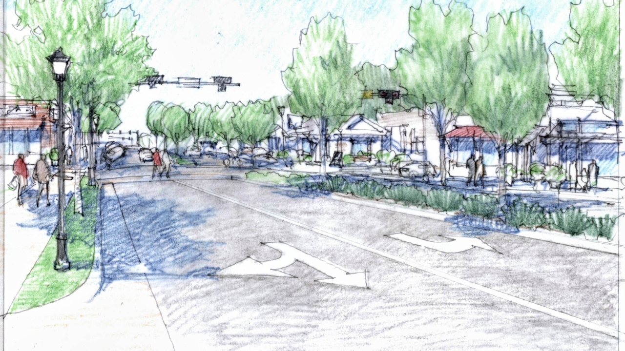
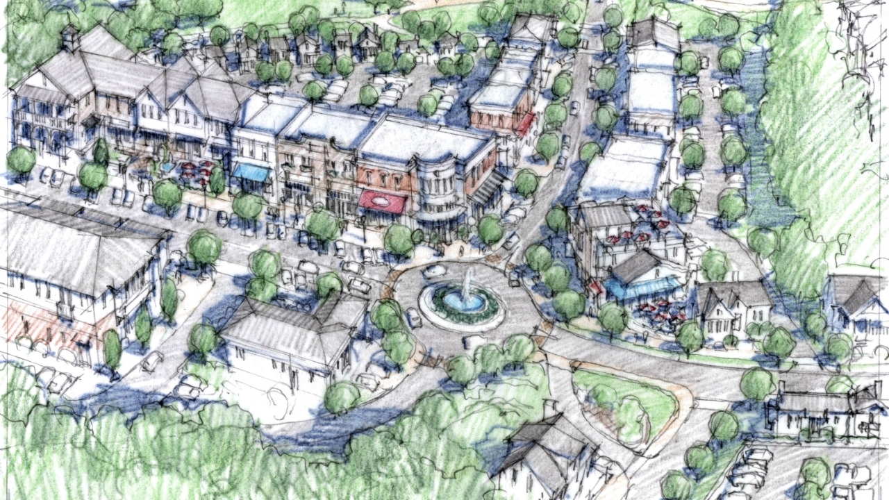
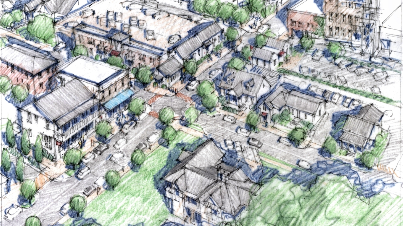
The overall design framework addressed these goals with improved, multimodal streetscapes with on-street parking on many Downtown streets, a greenway and parks / open space network following Stekoa Creek, a diversity of housing options, mixed-use development, an improved gateway at Savannah Street and 441, and zoning code updates to facilitate higher quality development. The following are key recommendations that resulted from extensive public input: