Details:
Highlights:
Description:
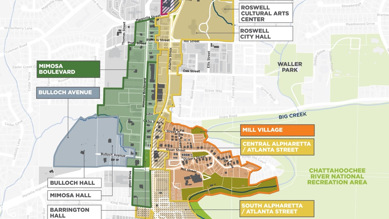
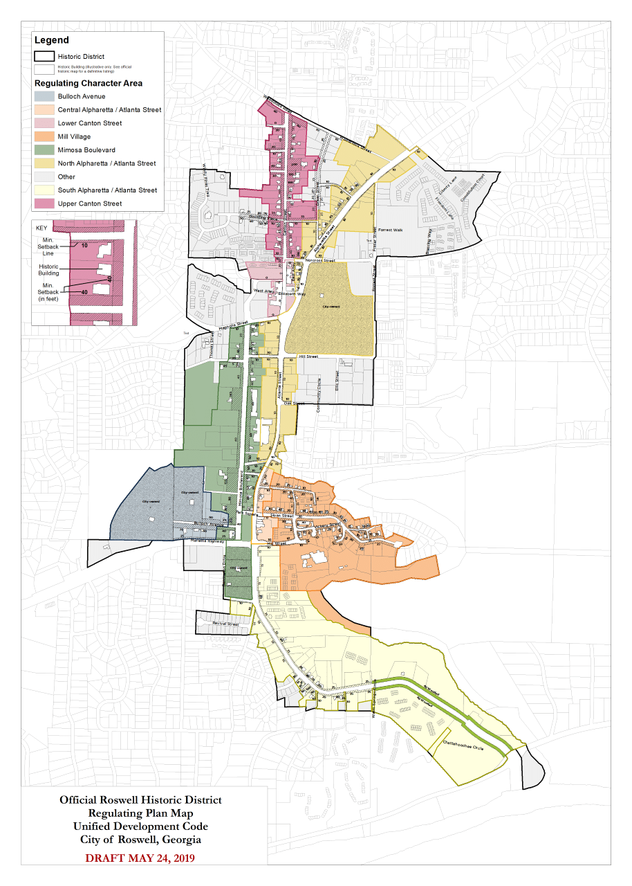
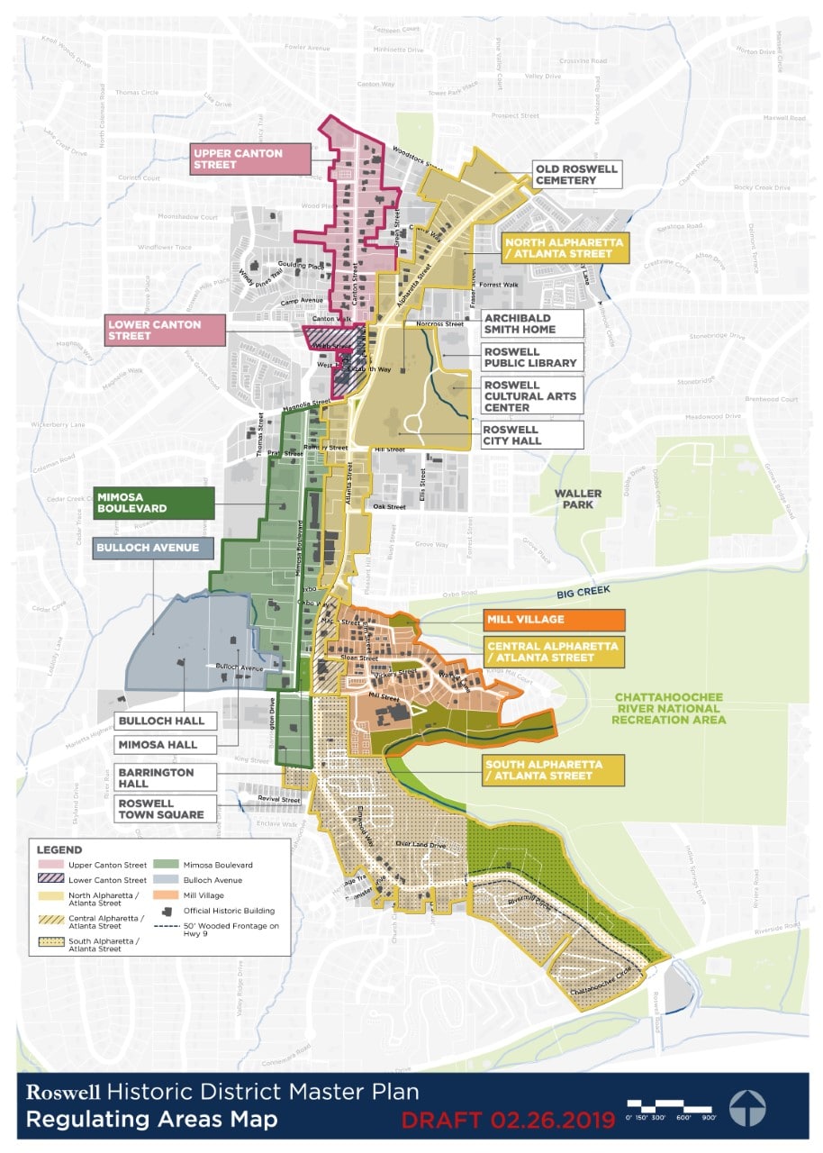
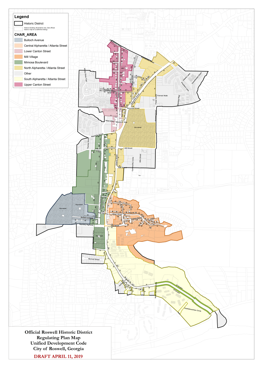
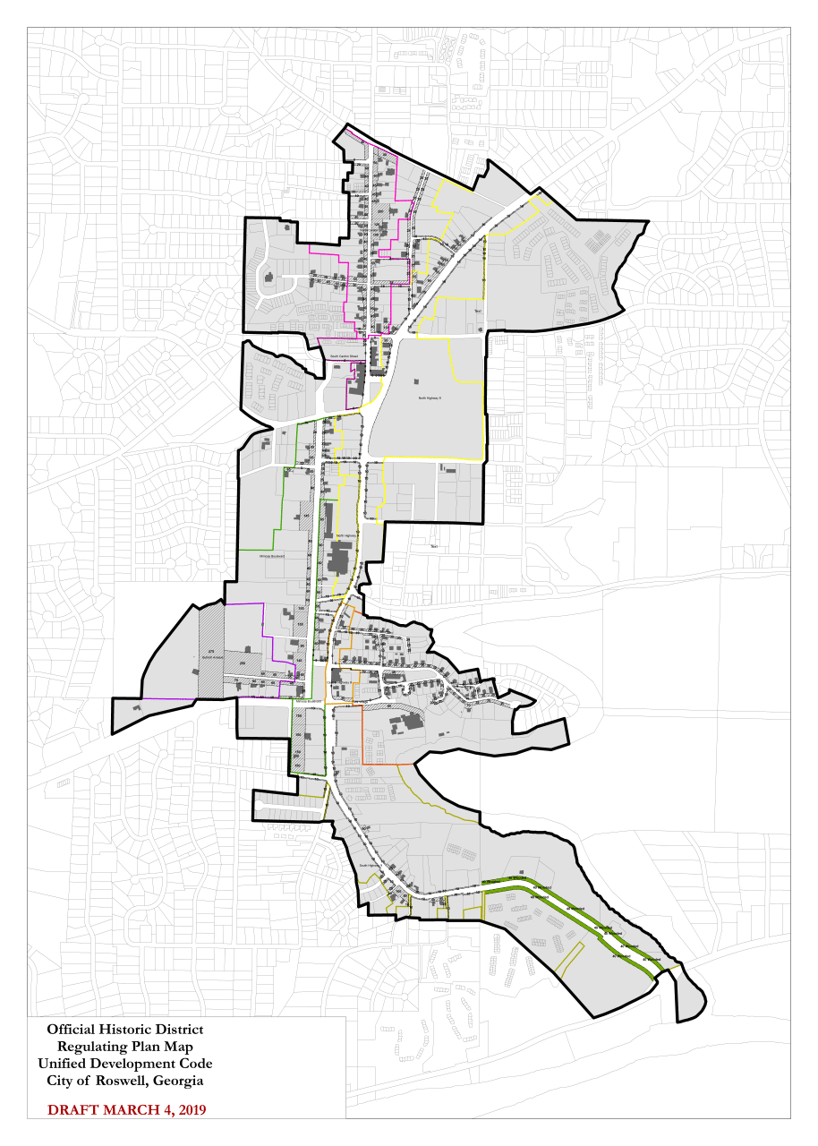
TSW developed a master plan and code changes for the Roswell Historic District, a 544-acre area that includes hundreds of historic buildings and key civic sites in the city’s core. The plan sought to develop a vision for the district’s future that would allow future growth without compromising its beloved historic character.
At the beginning of the process, TSW worked with stakeholders to understand the district’s-built patterns and how they might inform future development and code changes. This included analysis to identify pre-1968 buildings and their metrics, including setbacks, building types, building frontage, building heights, landscape frontage, and lot coverage. The analysis revealed no prevailing pattern throughout the entire district. However, it did identify patterns in certain character areas.
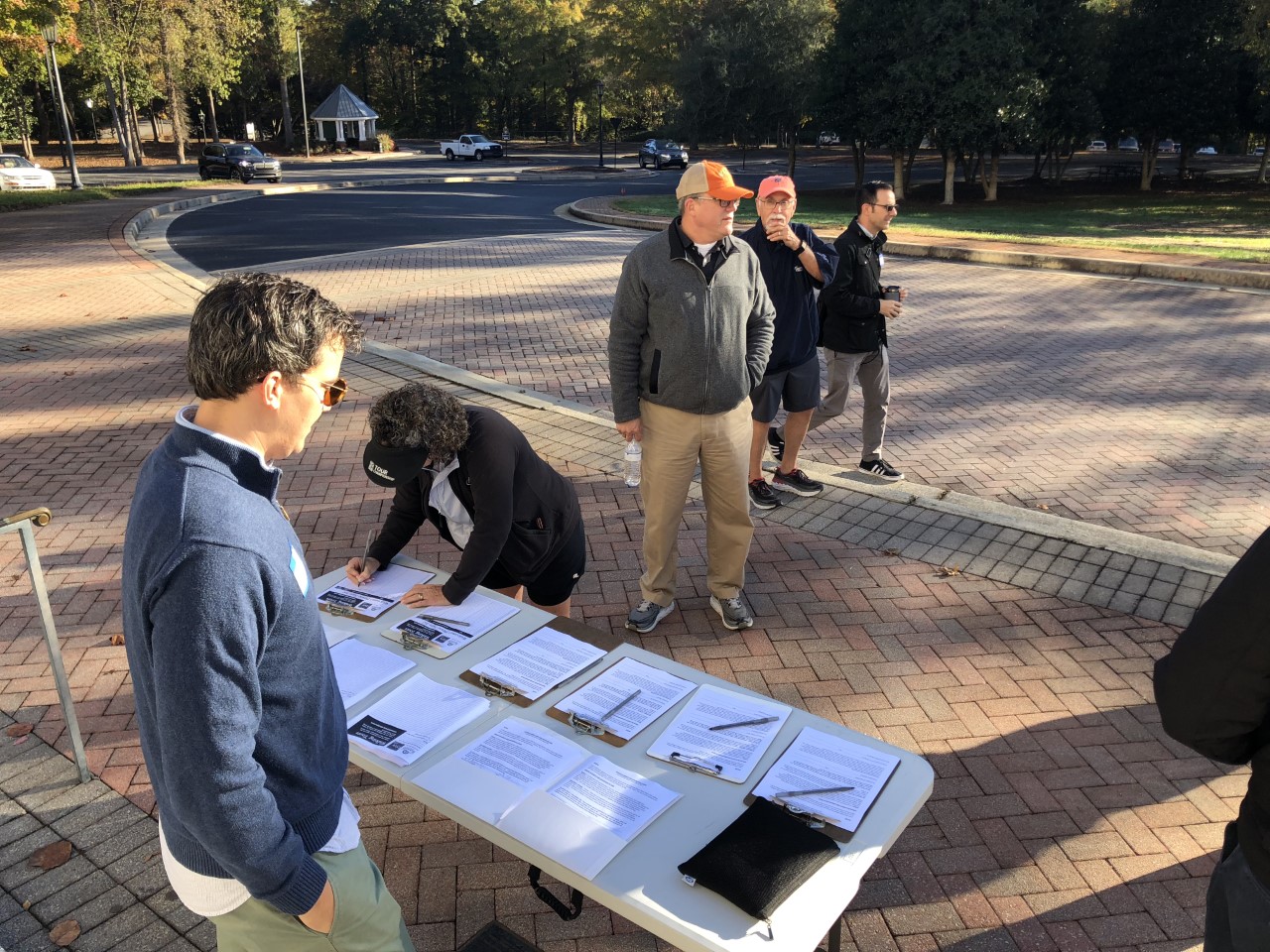
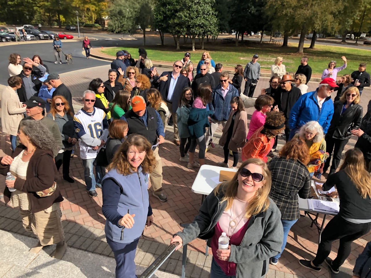
The master plan and code revisions were guided by a public process that included two days of walking tours with more than 160 participants, a two-day design workshop, advisory committee meetings, interviews, and other public meetings. The process focused heavily on exploring the appropriate relation between historic buildings and new development. This included exercises for the public to define current needs, a future vision, and how different types of code changes might affect the ability to achieve that vision. Illustrative building elevations and 3D modeling were used to illustrate what actual redevelopment sites in the district might look like under different scenarios. This made somewhat abstract coding concepts abundantly clear to the public and allowed a common vision to emerge.
Final plan recommendations were broken into four categories:
The plan also focused heavily on code changes that established character-area based regulations using varying levels of compatibility with historic resources in terms of building type, frontages, materials, etc. The idea behind the regulations was to define the most compatibility between historic and non-historic buildings in the character areas with the most historic resources or pronounced built patterns. In areas with fewer resources, such as along Highway 9, the code allowed for greater flexibility in new construction.