Details:
Highlights:
Description:
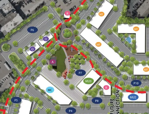
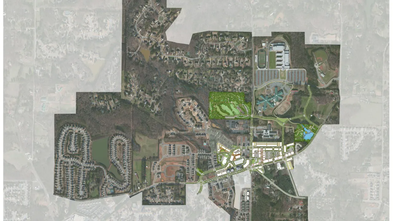
As part of the Downtown Milton/Crabapple Placemaking Plan, TSW led a consultant team to develop Milton’s Downtown Placemaking Plan within the Crabapple character area, originally established through a previous LCI study and Form-Based Code—both also led by TSW. The Form-Based Code promotes low-density development with small building footprints, while still encouraging a mix of uses. The Crabapple area has experienced notable growth centered around the historic Crossroads intersection, along with major public investments such as the relocation of City Hall (opened in 2017) and the construction of the new Milton Public Library. While the area features a strong retail core, surrounding single-family neighborhoods, and three community schools, the street network remains heavily automobile-oriented, limiting safety and accessibility for pedestrians.
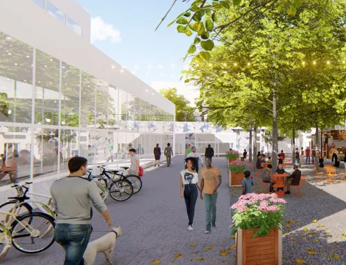
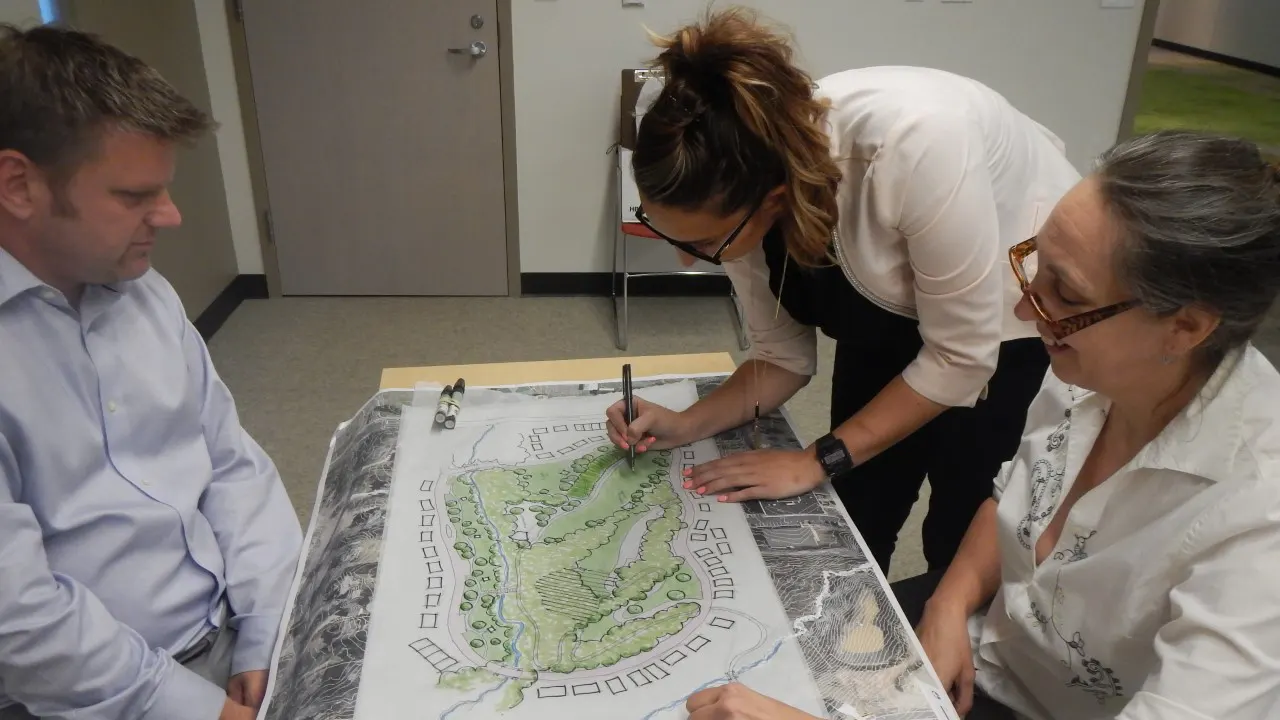
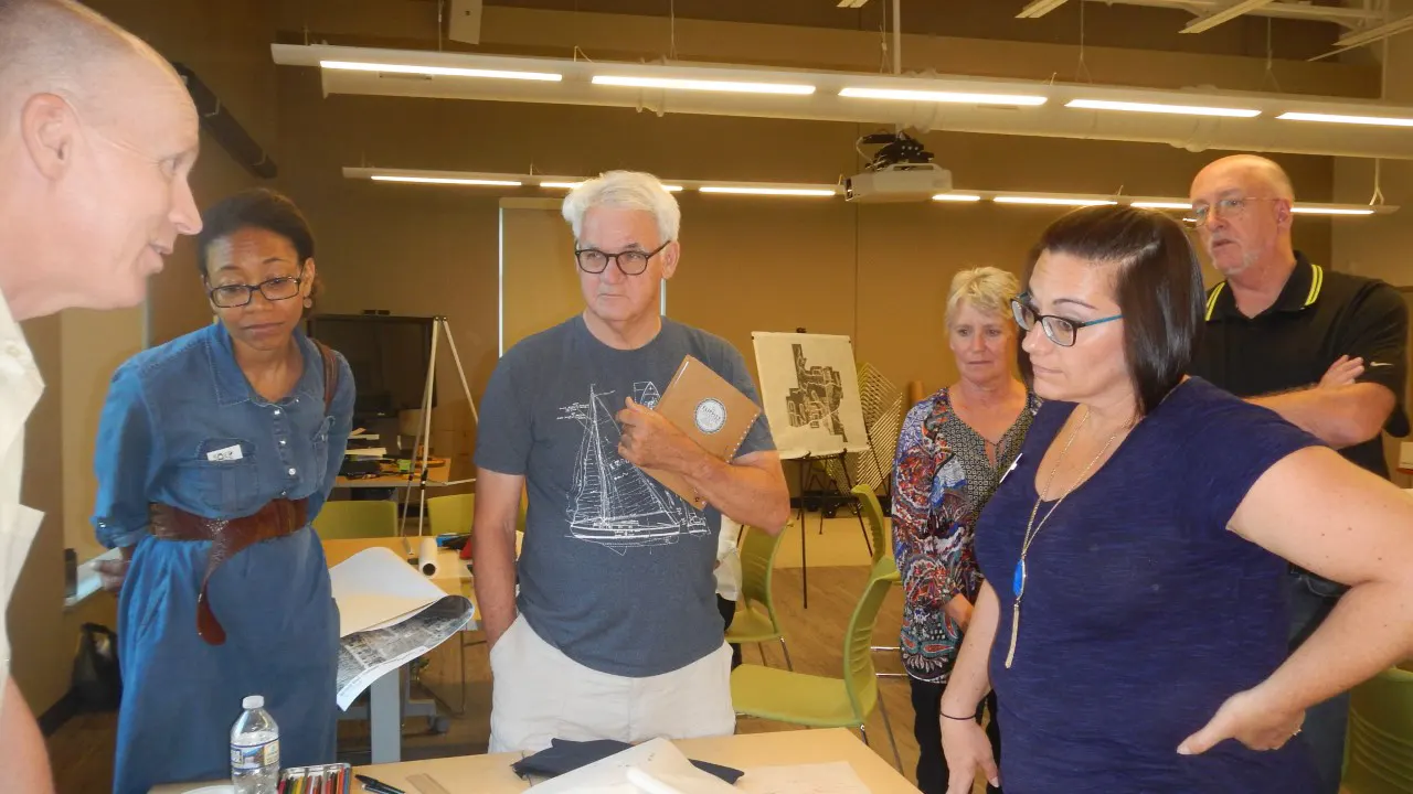
The placemaking plan involved an extensive public outreach effort with focus groups, steering committee meetings, open houses, and a 3-day charrette with the entire consultant team that included a walking audit and public input throughout the charrette.
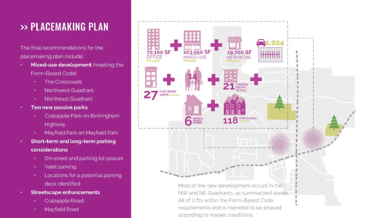
The Placemaking Plan consisted of design and policy goals:
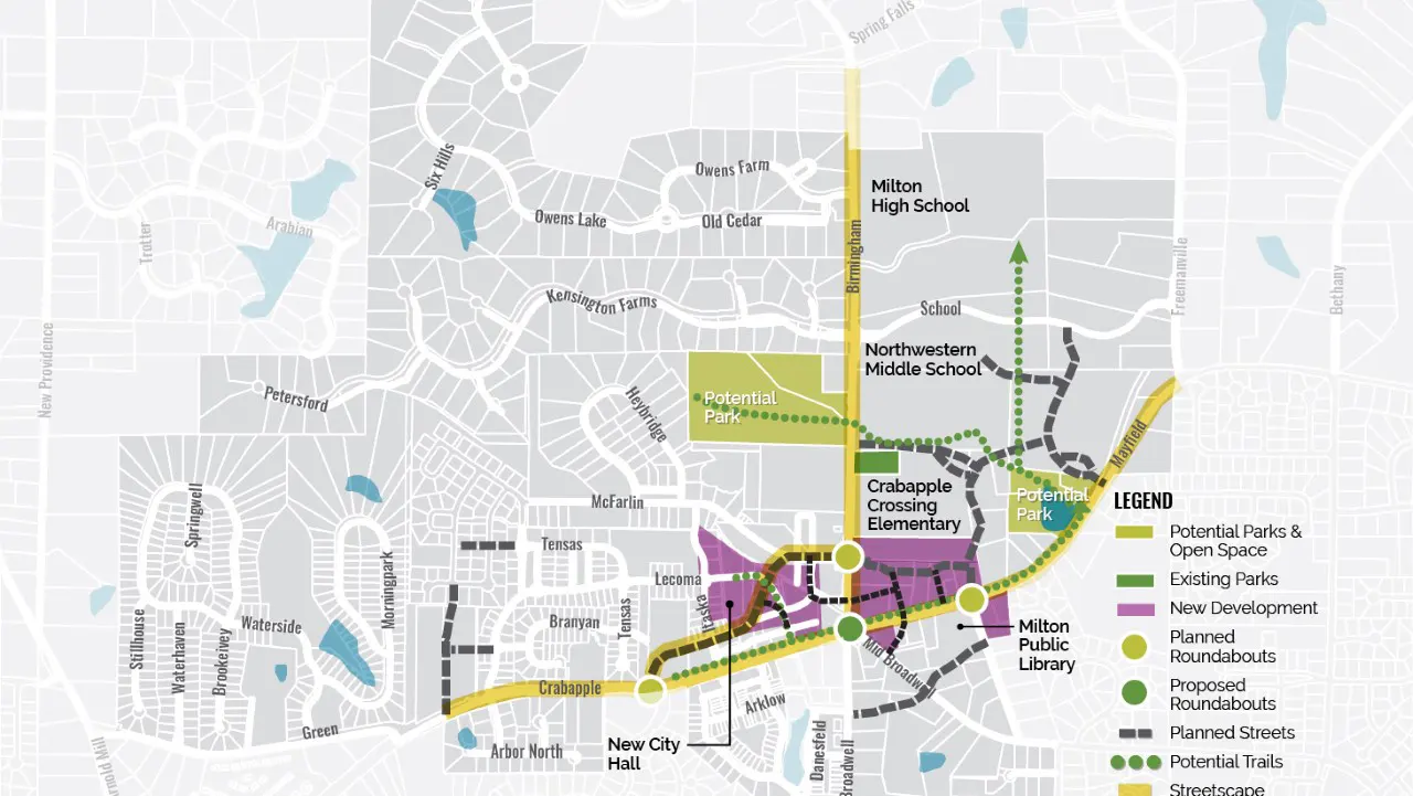
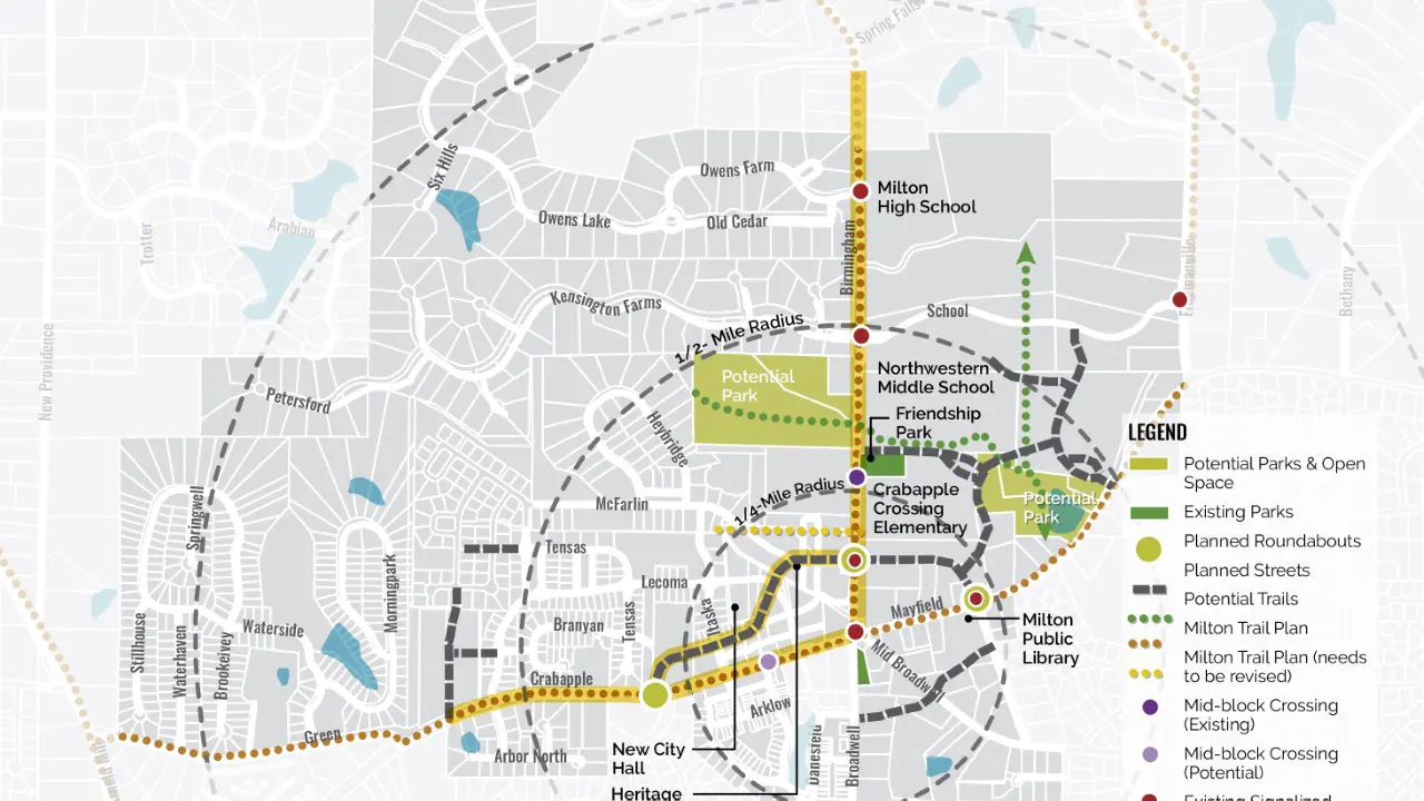
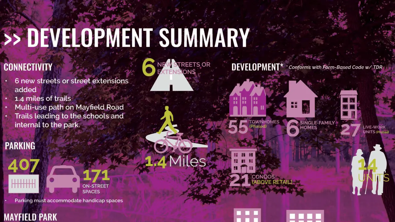
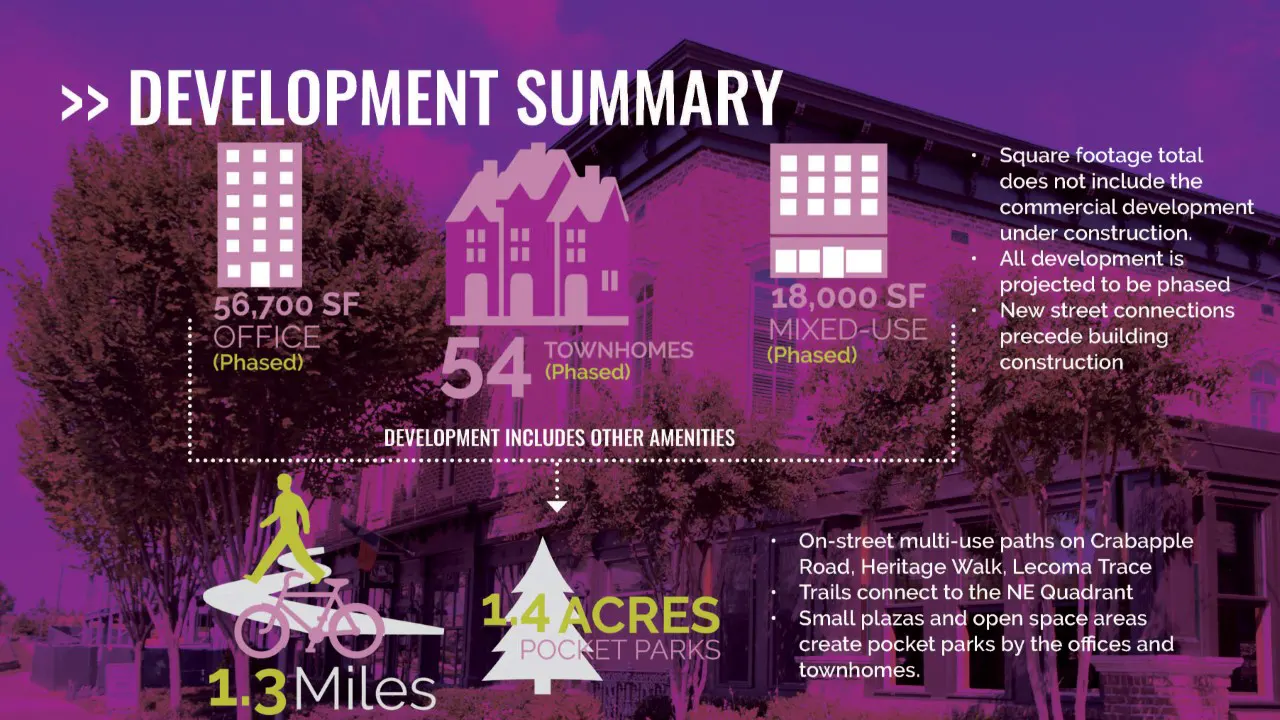
The overall design framework addressed these goals with park programming for two sites, a connected trail network along key streets and within the NE Quadrant, wider sidewalks and narrower vehicle lanes, development around the Crossroads, parking management, and adding new streets. The following are key design recommendations that resulted from an extensive existing conditions analysis, market analysis, and public input: