Details:
Highlights:
Description:
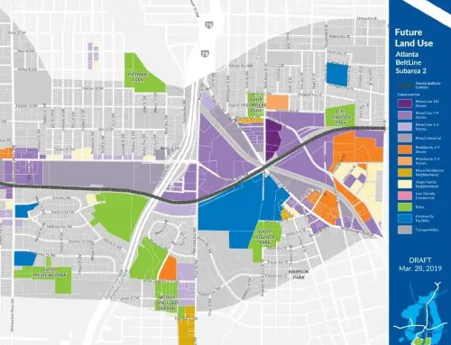
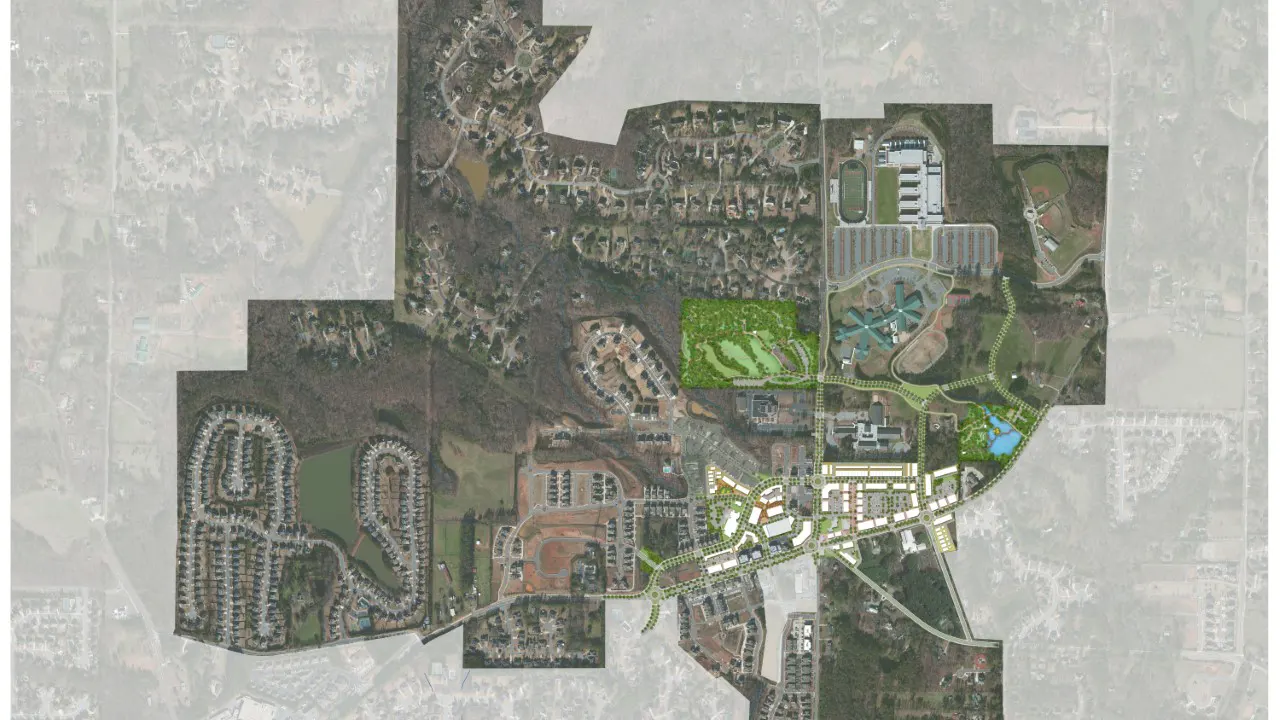
TSW led a consultant team to develop Milton’s Downtown Placemaking Plan in the Crabapple character area established in the previous LCI study and Form-Based Code (also TSW projects). The Form-Based Code encourages low-density and small building footprints but also encourages mixed-use development. The Crabapple area has seen recent growth focused around the historic Crossroads intersection and significant public investment with the relocation of the City Hall in the area (opening 2017) and the new Milton Public Library. The area has a strong retail core, single-family homes, and three community schools, but the street network is dominated by automobile-centric roads that reduce safety for pedestrians.
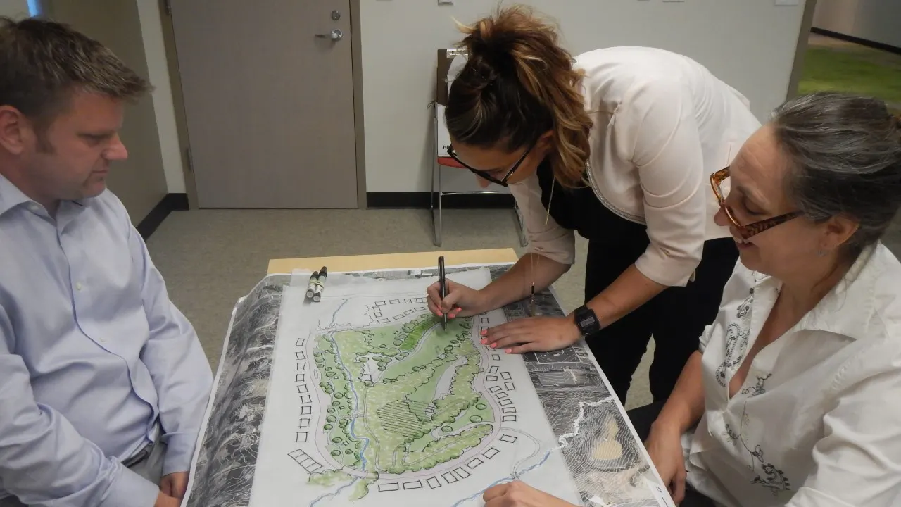
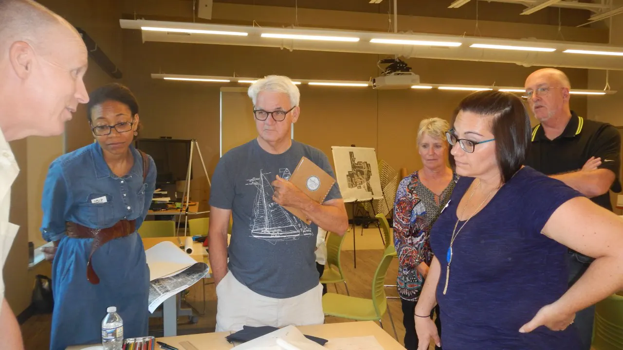
The placemaking plan involved an extensive public outreach effort with focus groups, steering committee meetings, open houses, and a 3-day charrette with the entire consultant team that included a walking audit and public input throughout the charrette.
The Placemaking Plan consisted of design and policy goals:
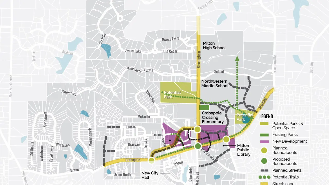
- Establish locations and programming for park space in the Crabapple area;
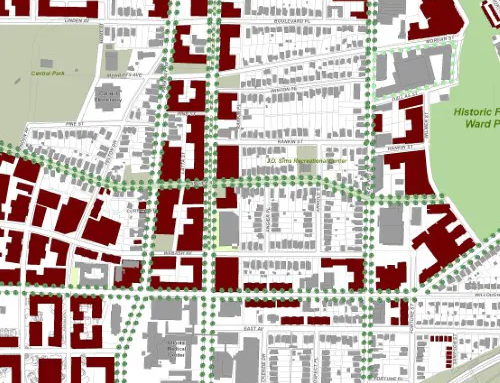
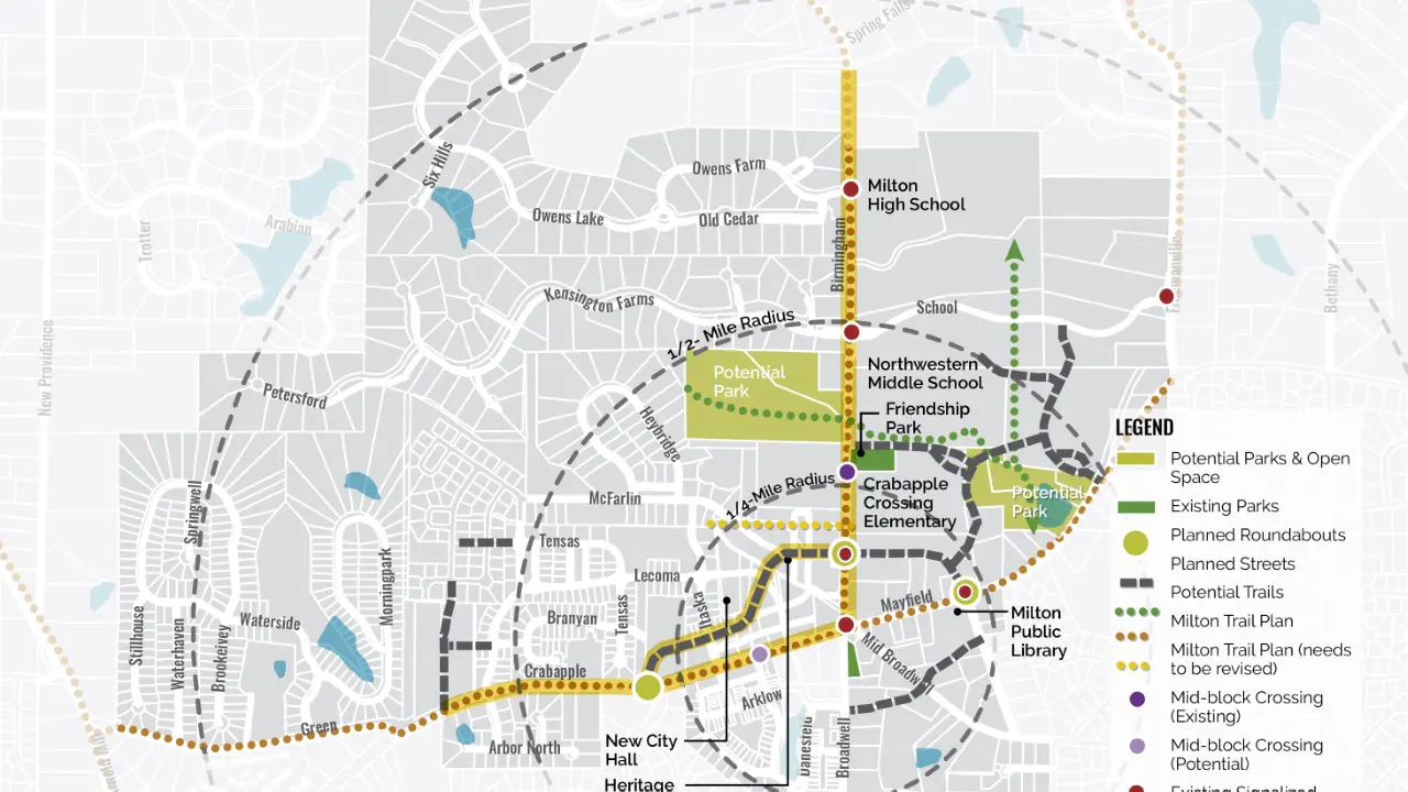
- Create a trail network that connects to sidewalks, schools, commercial development, and parks;
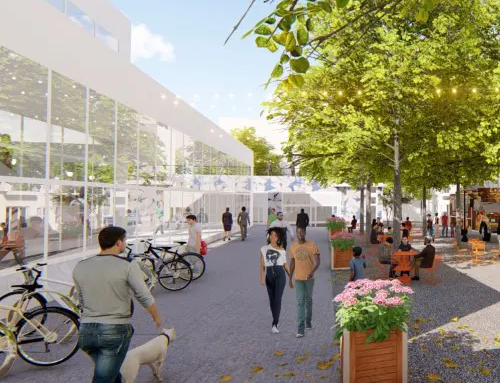
- Provide streetscape improvements that prioritize pedestrians on key streets;
- Establish a parking management strategy; and
- Locate development where appropriate, and determine the most suitable types of development.
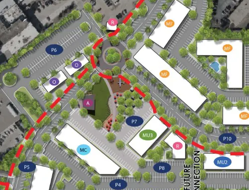
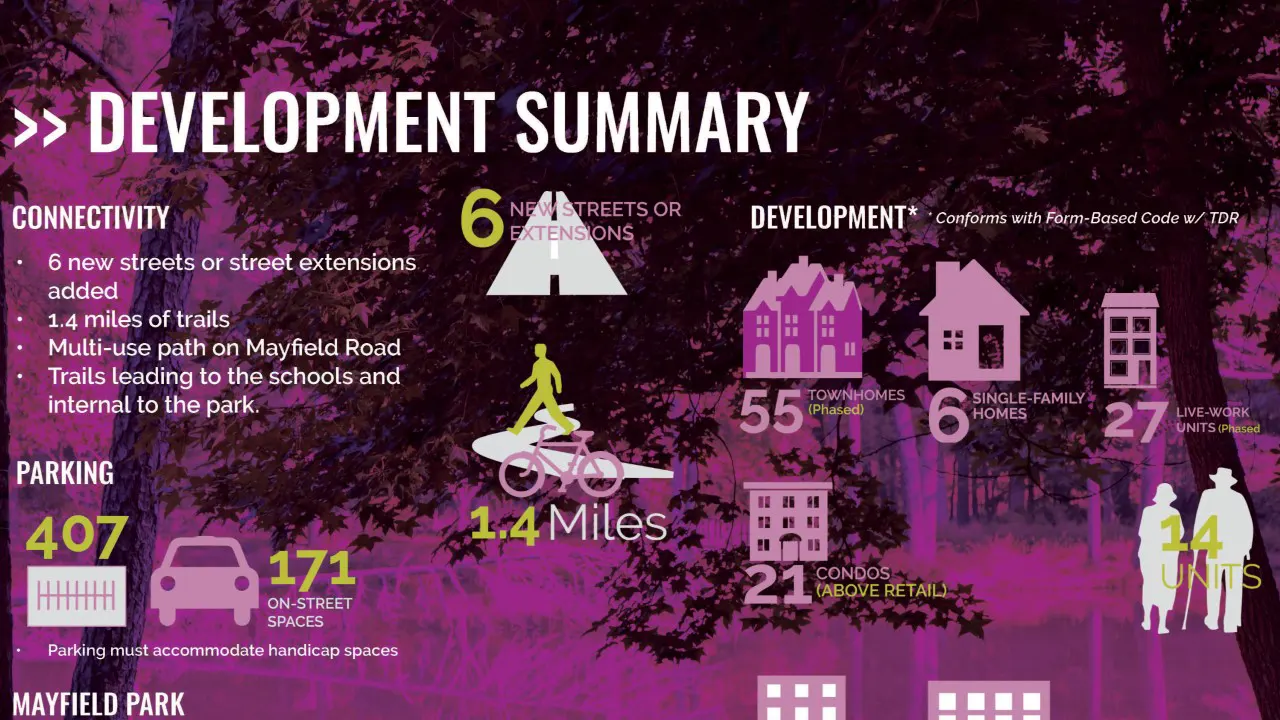
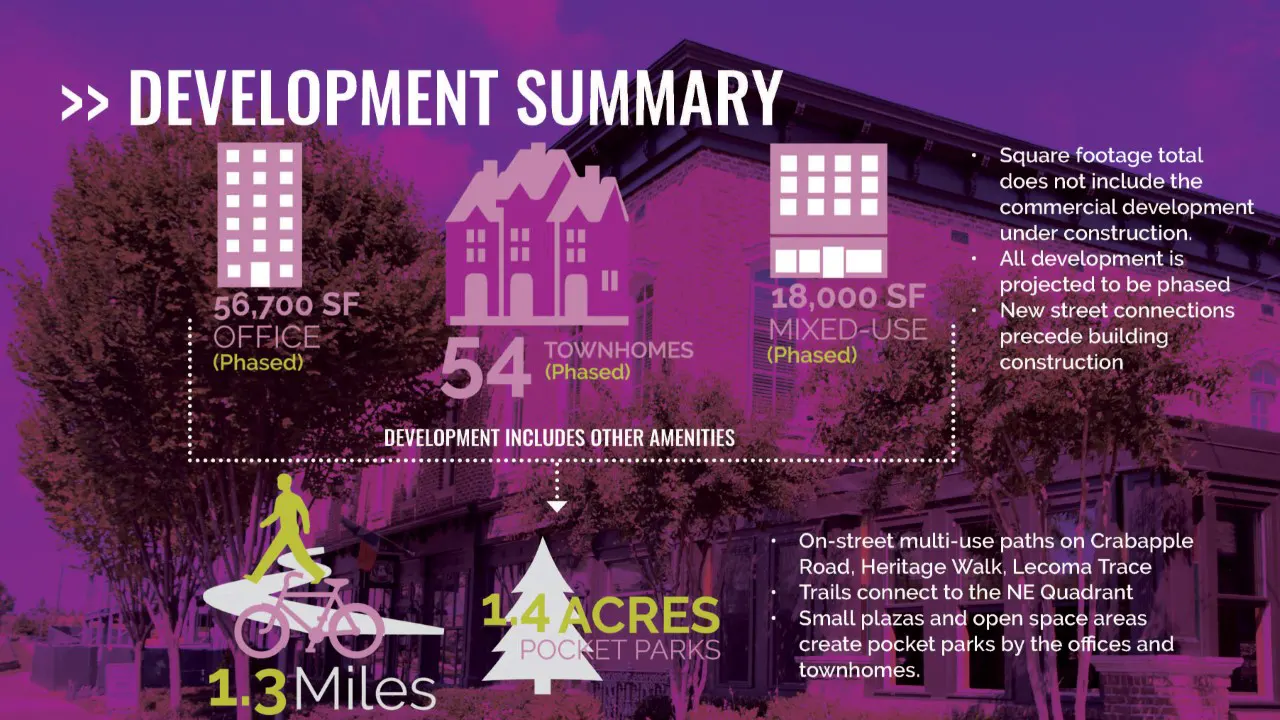
The overall design framework addressed these goals with park programming for two sites, a connected trail network along key streets and within the NE Quadrant, wider sidewalks and narrower vehicle lanes, development around the Crossroads, parking management, and adding new streets. The following are key design recommendations that resulted from an extensive existing conditions analysis, market analysis, and public input:
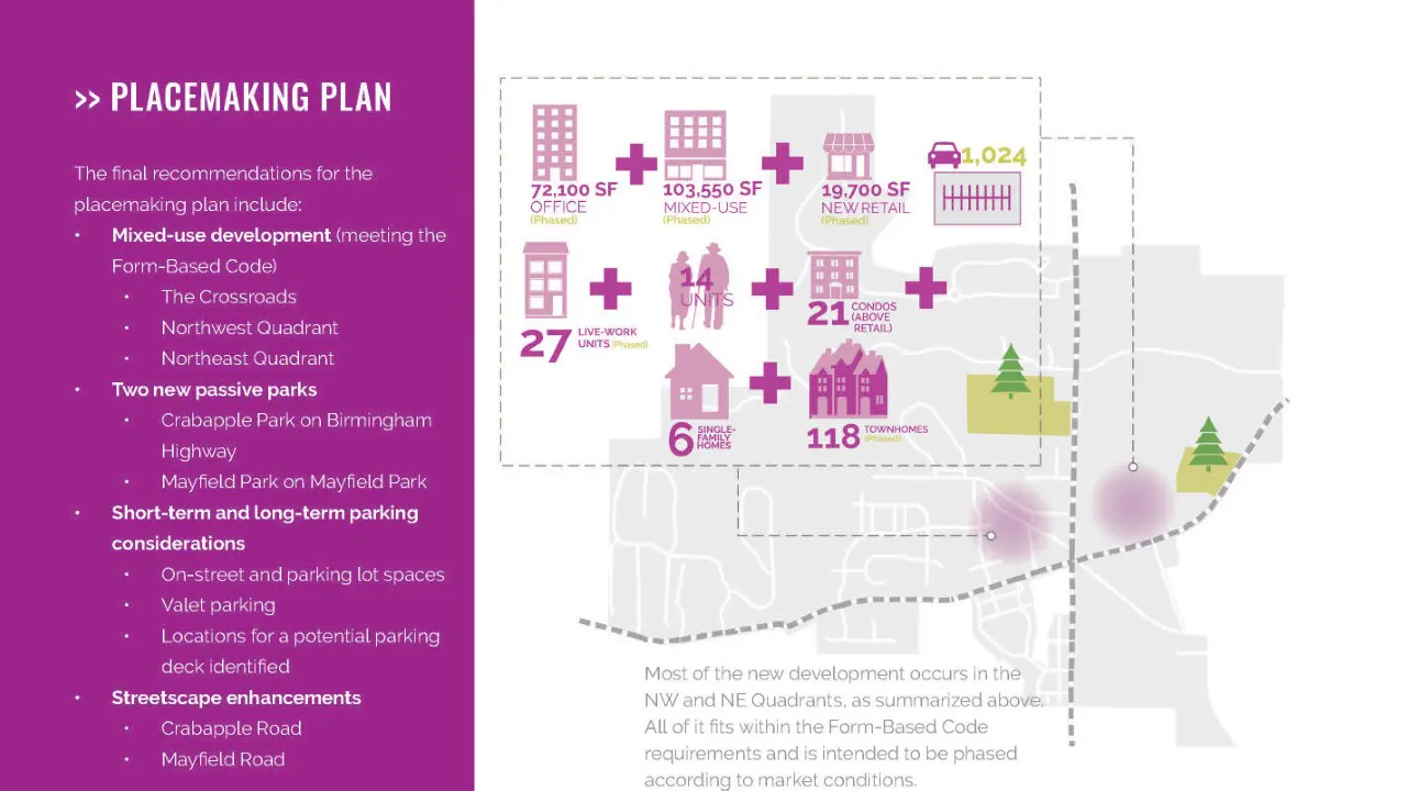
- Mixed-use development following the Form-Based Code in the Northwest and Northeast Quadrants around the Crossroads;
- Conceptual designs for two new parks on currently vacant, wooded land, that accommodate passive and educational activities;
- Short-term and long-term parking considerations (valet parking and potential parking deck);
- Streetscape enhancements on Crabapple Road, Mayfield Road, Birmingham Highway, and Heritage Walk (Phase 2) with wider sidewalks, on-street parking, bike facilities, and trees;
- Trails system on streets and between the schools and new parks.