Details:
Highlights:
Description:
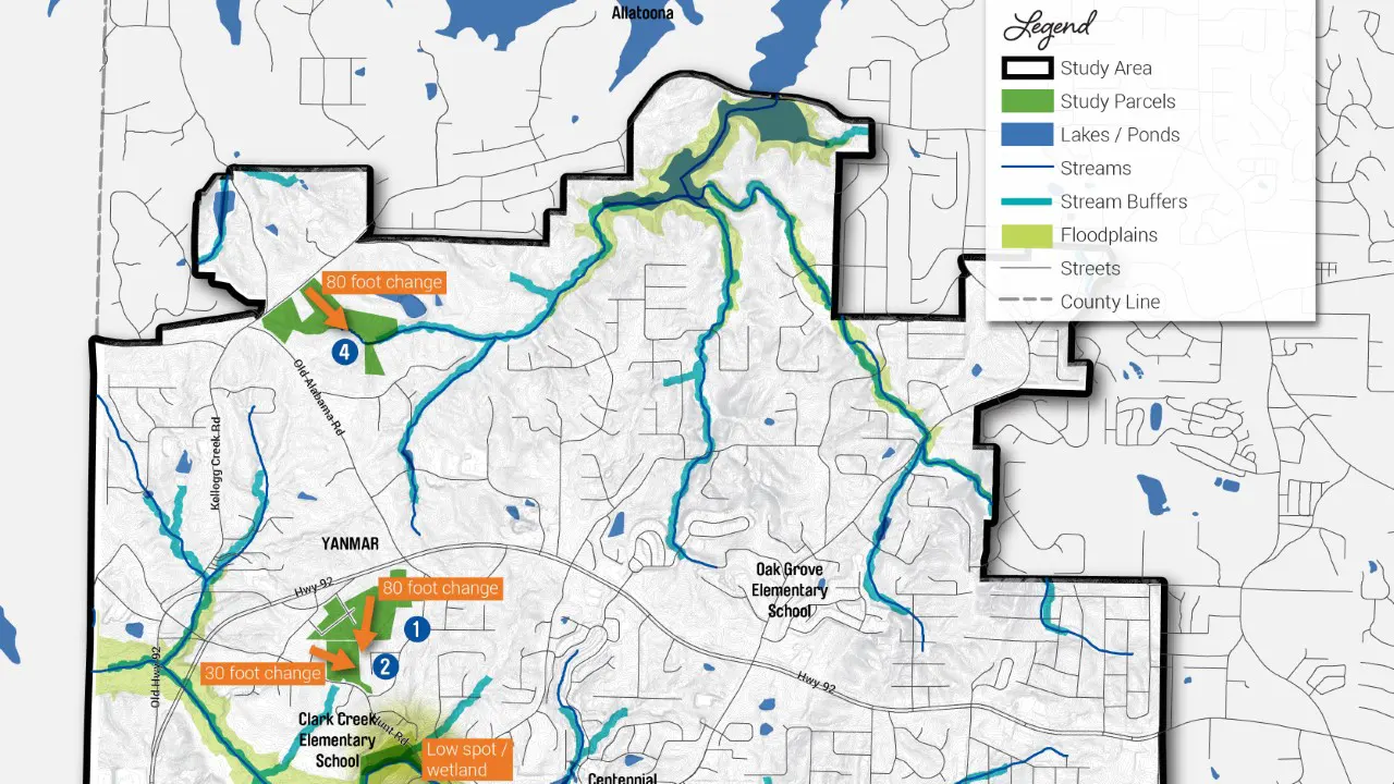
TSW’s Landscape Architecture Studio was hired by Cherokee County to create a comprehensive planning document for the southwest region of the county. The plan, titled the SW Cherokee County Parks & Trails Plan, focuses on parcels of land currently owned or leased by the county and includes detailed proposals for new public parks, recreational facilities, multi-use trails, and both bike and pedestrian pathways. The plan spans approximately 6,000 acres in total. The geographic boundaries include the Bartow County line on the west, Wade Green Road to the east, the Cobb County line to the south, and Kellogg Creek Road and U.S. Army Corps of Engineers property to the north.
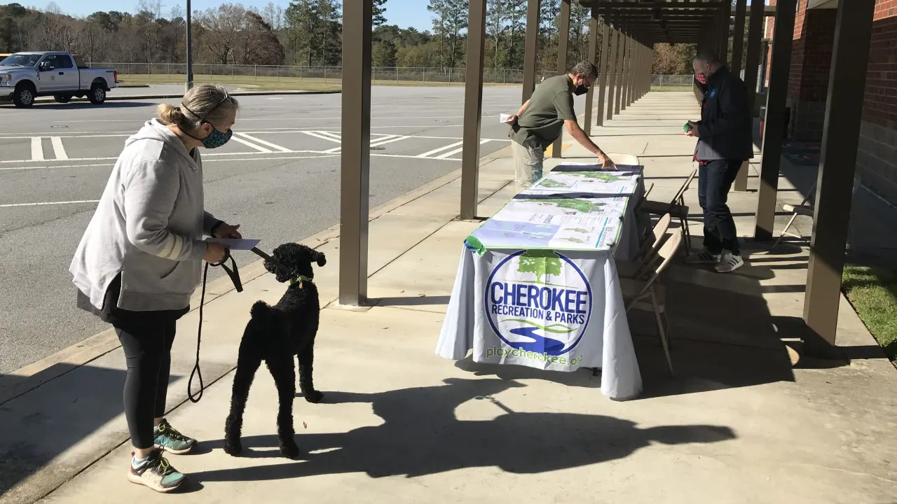
To gather broad and meaningful input from the community, TSW implemented a robust virtual public engagement process. This included stakeholder interviews, small focus groups, online surveys, a virtual kickoff meeting, several in-person pop-up events, and a virtual design workshop. The goal of these efforts was to develop a shared vision for the future of parks and trails in southwest Cherokee County and to gather public feedback on initial conceptual design options. These engagement methods allowed residents, community members, and park users to provide place-based feedback directly on interactive maps and visual concept alternatives.
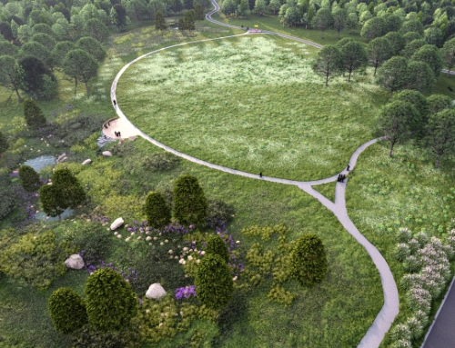
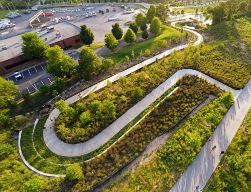
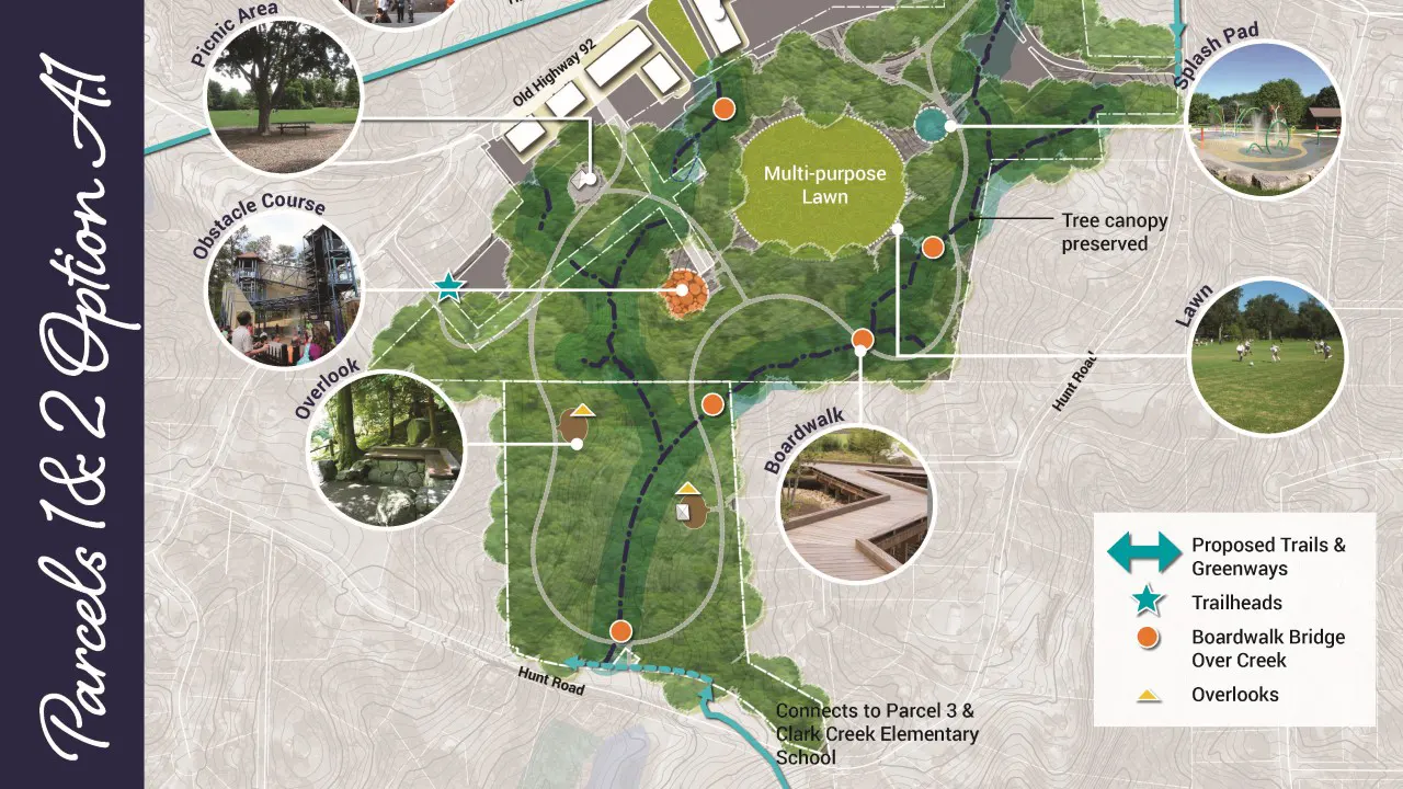
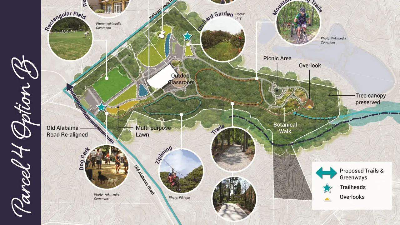
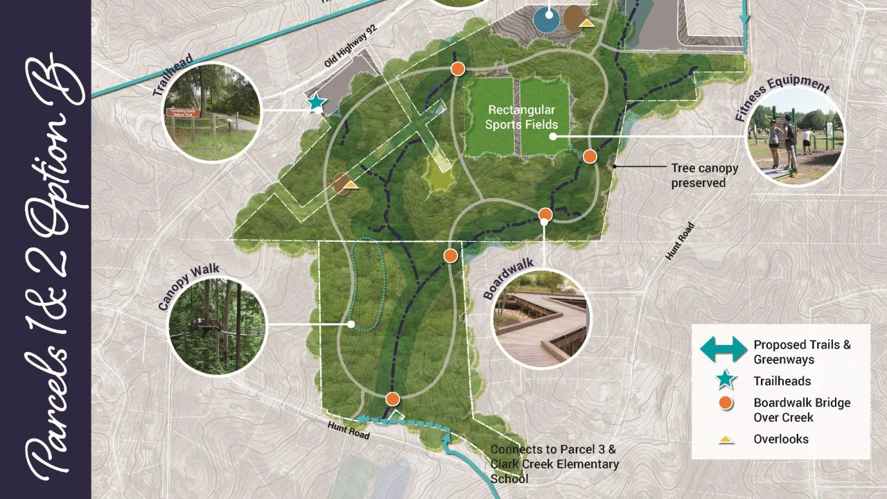
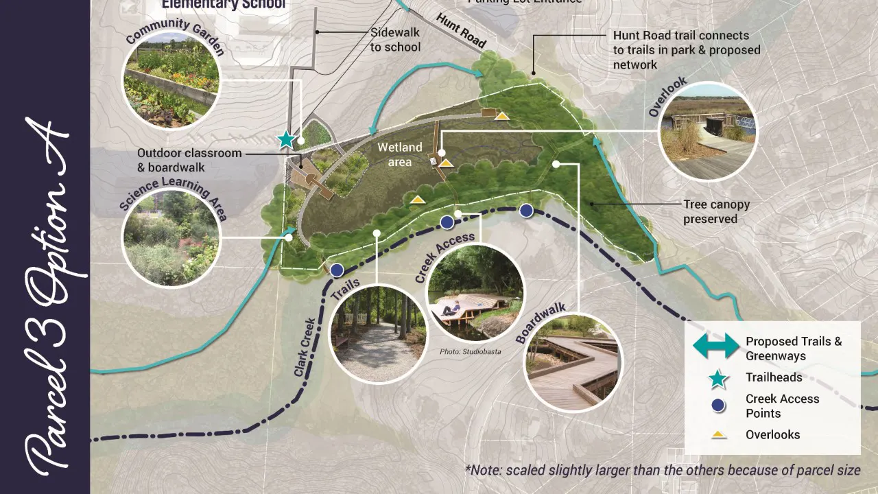
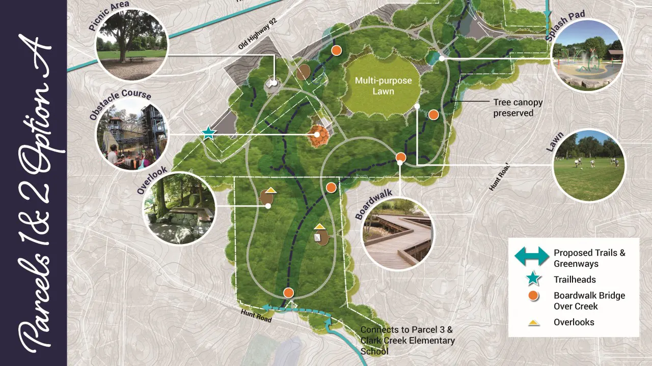
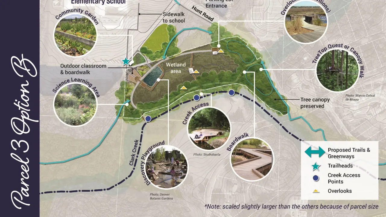
Using this community input as a foundation, TSW developed a series of conceptual plans for the proposed park and trail system. These plans span a total of 140 acres and feature a mix of passive and active recreational programming. For each site, TSW provided a minimum of two concept options for review. After collecting final feedback, the team refined and consolidated these ideas into a preferred concept plan for each location. The final plan also includes detailed construction cost estimates and a phased capital improvement program to guide future implementation.