Details:
Highlights:
Awards:
Description:
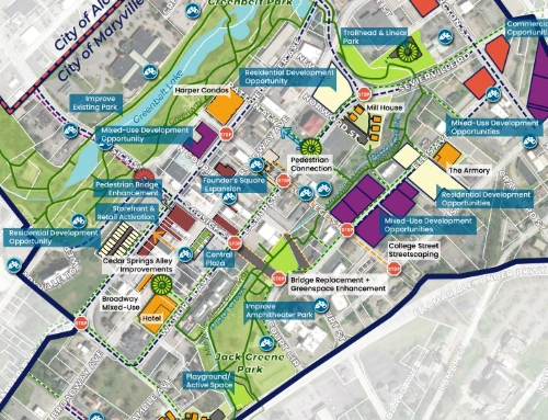
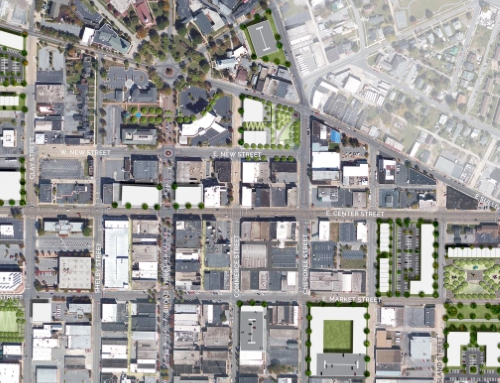
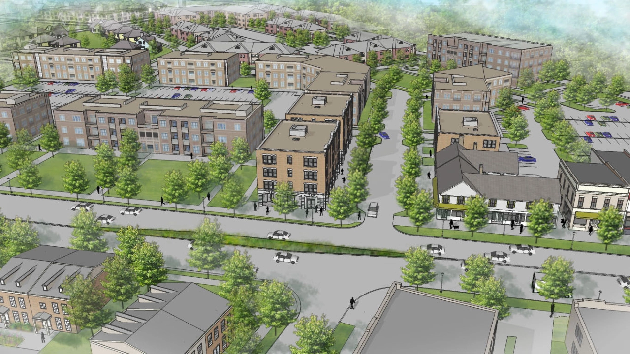
The Augusta Sustainable Development Implementation Program focuses on creating higher density, mixed-use, and mixed-income infill developments in appropriate locations along the corridor, while protecting surrounding single-family neighborhoods. To support the redevelopment, the corridor will include transit, pedestrian, and bicycle enhancements to provide transportation options for people of all ages and incomes.
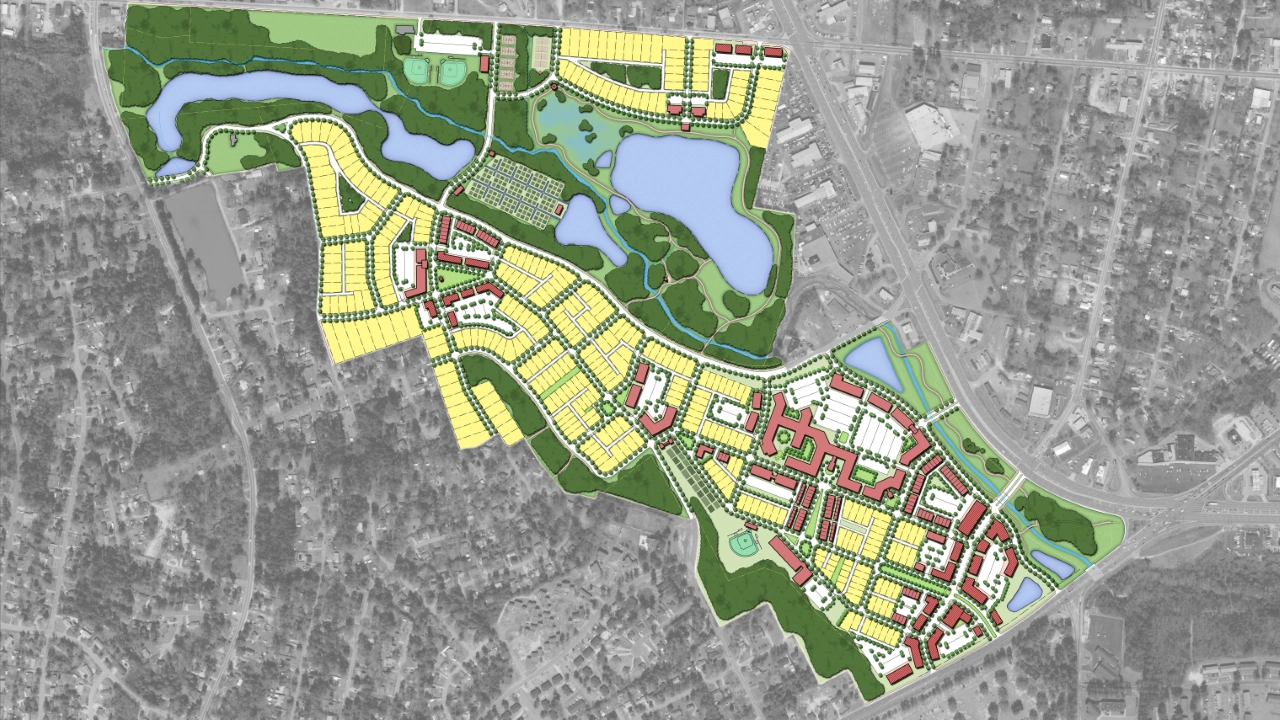
In addition, TSW examined opportunities for open spaces within the study area as revitalization continues and brings in more residents and workers. Located to the north of the vacant Regency Mall, Rocky Creek can be transformed into a premier park. Today Rocky Creek is for the most part inaccessible to the public. The site is located in the floodplain and occasionally experiences instances of flooding. The proposed park contains an extensive network of walking trails, basketball and tennis courts, baseball fields, open spaces, stream overlooks, pavilions, and a community garden for public enjoyment.
The planning process involved extensive community outreach to engage residents, business owners, and other stakeholders in the study area through a community charrette, visual preference survey, stakeholder interviews, and numerous public meetings to present ideas and gather feedback.
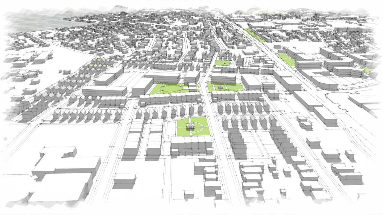
The Augusta Sustainable Development Implementation Program focuses on creating higher density, mixed-use, and mixed-income infill developments in appropriate locations along the corridor, while protecting surrounding single-family neighborhoods. To support the redevelopment, the corridor will include transit, pedestrian, and bicycle enhancements to provide transportation options for people of all ages and incomes.
In addition, TSW examined opportunities for open spaces within the study area as revitalization continues and brings in more residents and workers. Located to the north of the vacant Regency Mall, Rocky Creek can be transformed into a premier park. Today Rocky Creek is for the most part inaccessible to the public. The site is located in the floodplain and occasionally experiences instances of flooding. The proposed park contains an extensive network of walking trails, basketball and tennis courts, baseball fields, open spaces, stream overlooks, pavilions, and a community garden for public enjoyment.
The planning process involved extensive community outreach to engage residents, business owners, and other stakeholders in the study area through a community charrette, visual preference survey, stakeholder interviews, and numerous public meetings to present ideas and gather feedback.